
Municipio Tomave topographic map
Interactive map
Click on the map to display elevation.
About this map
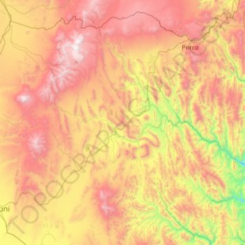
Name: Municipio Tomave topographic map, elevation, terrain.
Location: Municipio Tomave, Antonio Quijarro, Potosí, Bolivia (-20.61279 -66.93044 -19.60484 -65.87534)
Average elevation: 3,989 m
Minimum elevation: 2,849 m
Maximum elevation: 5,434 m