
Songxi topographic map
Interactive map
Click on the map to display elevation.
About this map
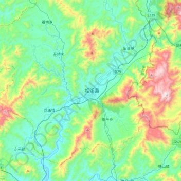
Name: Songxi topographic map, elevation, terrain.
Location: Songxi, Songxi County, Nanping City, Fujian, PRC (27.36973 118.62044 27.68973 118.94044)
Average elevation: 460 m
Minimum elevation: 160 m
Maximum elevation: 1,367 m