
Camiña topographic map
Interactive map
Click on the map to display elevation.
About this map
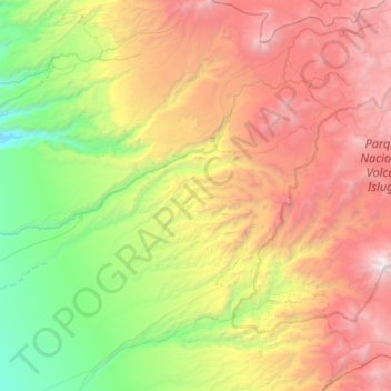
Name: Camiña topographic map, elevation, terrain.
Location: Camiña, Provincia del Tamarugal, Región de Tarapacá, Chili (-19.69900 -69.75829 -19.06804 -69.14294)
Average elevation: 2,781 m
Minimum elevation: 1,128 m
Maximum elevation: 5,248 m