
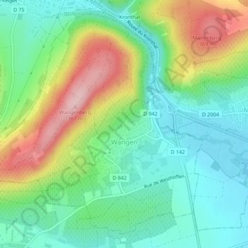
Wangen topographic map
Interactive map
Click on the map to display elevation.
About this map
Name: Wangen topographic map, elevation, terrain.
Average elevation: 249 m
Minimum elevation: 180 m
Maximum elevation: 380 m
Other topographic maps
Click on a map to view its topography, its elevation and its terrain.
Seebach
Frankreich > Grand Est > Unterelsass
Seebach, Hagenau-Weißenburg, Unterelsass, Grand Est, Metropolitanes Frankreich, 67160, Frankreich
Average elevation: 165 m
Hatten
Frankreich > Grand Est > Unterelsass
Hatten, Hagenau-Weißenburg, Unterelsass, Grand Est, Metropolitanes Frankreich, 67690, Frankreich
Average elevation: 139 m
Weißenburg
Frankreich > Grand Est > Unterelsass
Weißenburg, Hagenau-Weißenburg, Unterelsass, Grand Est, Metropolitanes Frankreich, 67160, Frankreich
Average elevation: 223 m