
Fanø Bad topographic map
Interactive map
Click on the map to display elevation.
About this map
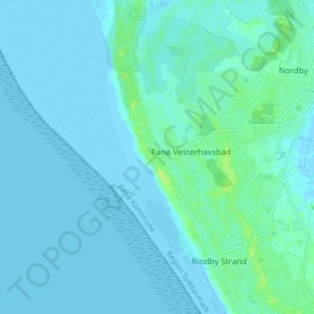
Name: Fanø Bad topographic map, elevation, terrain.
Location: Fanø Bad, Fanø Kommune, Zuid-Denemarken, 6720, Denemarken (55.41427 8.34550 55.45427 8.38550)
Average elevation: 2 m
Minimum elevation: -1 m
Maximum elevation: 12 m