
Col de Sié topographic map
Interactive map
Click on the map to display elevation.
About this map
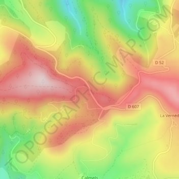
Name: Col de Sié topographic map, elevation, terrain.
Average elevation: 909 m
Minimum elevation: 706 m
Maximum elevation: 1,071 m
Other topographic maps
Click on a map to view its topography, its elevation and its terrain.
Puech de Rascas
Puech de Rascas, Lacaune, Castres, Tarn, Occitanie, France métropolitaine, 81230, France
Average elevation: 1,127 m
La Vernède
France > Occitanie > Lacaune > La Vernède
La Vernède, Lacaune, Castres, Tarn, Occitanie, France métropolitaine, 81230, France
Average elevation: 890 m
Refuge de Picotalen
Refuge de Picotalen, D 907, Lugan, Lacaune, Castres, Tarn, Occitanie, France métropolitaine, 81230, France
Average elevation: 962 m