Geolocate

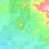
Middle Mountain topographic map

Click on the map to display elevation.

About this map

Name: Middle Mountain topographic map, elevation, terrain.

Location: Middle Mountain, Phoenix, Maricopa County, Arizona, 85085, United States (33.74986 -112.13245 33.74996 -112.13235)

Average elevation: 469 m

Minimum elevation: 453 m

Maximum elevation: 541 m

Other topographic maps

Click on a map to view its topography, its elevation and its terrain.

Deer Valley

United States > Arizona > Maricopa County > Phoenix

Average elevation: 441 m

Bird Lake

United States > Arizona > Maricopa County > Phoenix

Average elevation: 345 m

Papago Park

United States > Arizona > Maricopa County > Phoenix

The Ponds have a surface area of 6 acres (2.4 ha) with an average depth of 8 ft (2.4 m), the elevation of the area is 1,100 ft (340 m).

Average elevation: 383 m

Sumida Park

United States > Arizona > Maricopa County > Phoenix

Average elevation: 403 m

New River

United States > Arizona > Maricopa County > Phoenix

Average elevation: 690 m

Gear up for your next adventure:

🧰Survival Kits - Essential survival gear
🦘Outback Survival Gear - Essential gear for Australian outback
🎒Hiking Backpacks - Backpacks designed for hiking and trekking
🥾Hiking Boots - Durable hiking boots for trails and rough terrain
🌬️Windbreaker Jackets - Wind protection jackets

As an Amazon Associate, this site earns from qualifying purchases at no extra cost to you.