Geolocate

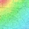
Cibiru topographic map

Click on the map to display elevation.

About this map

Name: Cibiru topographic map, elevation, terrain.

Location: Cibiru, Bandung City, West Java, Indonesia (-6.93506 107.70883 -6.89506 107.73952)

Average elevation: 778 m

Minimum elevation: 669 m

Maximum elevation: 1,082 m

Other topographic maps

Click on a map to view its topography, its elevation and its terrain.

Taman Lansia

Indonesia > West Java > Bandung City

Average elevation: 724 m

Taman Cibeunying

Indonesia > West Java > Bandung City > Cihapit

Average elevation: 717 m

Tegallega Park

Indonesia > West Java > Bandung City > Ciateul

Average elevation: 695 m

Taman Gesit

Indonesia > West Java > Bandung City > Lebak Gede

Average elevation: 746 m

Taman Pramuka

Indonesia > West Java > Bandung City > Cihapit

Average elevation: 707 m

Gear up for your next adventure:

🧊Insulated Stainless Steel Flasks - Keep water cold for 24 hours in the heat or coffee hot in the cold
🔦Powerful LED Headlamps - Hands-free lighting for night navigation and setting up camp after dark
🩹Wilderness First Aid Kits - Comprehensive medical kits tailored for hiking and remote exploration
👄SPF Lip Balm - Prevent sun and wind-burnt lips on mountain ridges
📦Crushproof Equipment Cases - Safe transport for sensitive surveying and mapping instruments

As an Amazon Associate, this site earns from qualifying purchases at no extra cost to you.