Geolocate

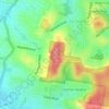
Bulimba topographic map

Click on the map to display elevation.

About this map
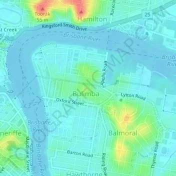
Name: Bulimba topographic map, elevation, terrain.

Location: Bulimba, City of Brisbane, Queensland, Australia (-27.45726 153.04854 -27.44074 153.07208)

Average elevation: 11 m

Minimum elevation: -3 m

Maximum elevation: 59 m

Queensland trails, hiking, mountain biking, running and outdoor activities

Other topographic maps

Click on a map to view its topography, its elevation and its terrain.

Bulimba Creek

Australia > Queensland > City of Brisbane

Average elevation: 11 m

Tangalooma

Australia > Queensland > City of Brisbane

Average elevation: 41 m

Enoggera Hill

Australia > Queensland > City of Brisbane

Average elevation: 114 m

Enoggera Dam

Australia > Queensland > City of Brisbane

Average elevation: 90 m

Tangalooma

Australia > Queensland > City of Brisbane

Average elevation: 41 m

Blunder Creek

Australia > Queensland > City of Brisbane

Average elevation: 26 m

Gear up for your next adventure:

🖼️Scratch-off Australia Map - Track the regions and peaks you have explored geographically
🧤Thermal Hiking Gloves - Keep your hands warm and functional during high-altitude winter treks
🦟Insect Repellent - Protection against insects
🛌Sleeping Bags - Sleeping bags for outdoor camping
🔌Fast Charging Adapters - Quickly top up all your gear before heading back into the field

As an Amazon Associate, this site earns from qualifying purchases at no extra cost to you.