Geolocate

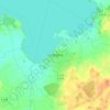
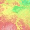
Kimstad topographic map

Click on the map to display elevation.

About this map

Name: Kimstad topographic map, elevation, terrain.

Location: Kimstad, Norrköpings kommun, Östergötland County, 617 71, Sweden (58.52892 15.94891 58.56892 15.98891)

Average elevation: 42 m

Minimum elevation: 21 m

Maximum elevation: 73 m

Other topographic maps

Click on a map to view its topography, its elevation and its terrain.
Knabben

Sweden > Östergötland County > Norrköping

Average elevation: 45 m

Vadstena

Sweden > Östergötland County

Average elevation: 98 m

Mjölby kommun

Sweden > Östergötland County

Average elevation: 123 m

Navestad

Sweden > Östergötland County > Norrköping

Average elevation: 34 m

Nässja

Sweden > Östergötland County

Average elevation: 91 m

Illern

Sweden > Östergötland County > Linköping

Average elevation: 72 m

Kinda kommun

Sweden > Östergötland County

Average elevation: 133 m

Halgen

Sweden > Östergötland County

Average elevation: 88 m

Gear up for your next adventure:

🏫Topographic World Globes - 3D physical relief globes to understand global geography
📷Backpack Camera Clips - Quick access to your camera while keeping your hands free for climbing
🛰️Handheld GPS Units - Rugged GPS devices for tracking coordinates and elevation in the Australian bush
📣High-Decibel Survival Whistles - Signaling tool for rescue that carries much further than a human voice
👣Snake & Scrub Gaiters - Protection against spinifex, mud, and snakes while walking off-track

As an Amazon Associate, this site earns from qualifying purchases at no extra cost to you.