
Thank you for supporting this site ❤️
Make a donation
Make a donation
Gear up for your next adventure:
As an Amazon Associate, this site earns from qualifying purchases at no extra cost to you.
Viento topographic map
Click on the map to display elevation.
Thank you for supporting this site ❤️
Make a donation
Make a donation
Gear up for your next adventure:
As an Amazon Associate, this site earns from qualifying purchases at no extra cost to you.
About this map
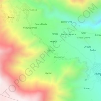
Name: Viento topographic map, elevation, terrain.
Location: Viento, Pampacolca, Province of Castilla, Arequipa, Peru (-15.72528 -72.61501 -15.68528 -72.57501)
Average elevation: 3,290 m
Minimum elevation: 2,774 m
Maximum elevation: 3,997 m
Thank you for supporting this site ❤️
Make a donation
Make a donation
Gear up for your next adventure:
As an Amazon Associate, this site earns from qualifying purchases at no extra cost to you.