
Southfield topographic map
Interactive map
Click on the map to display elevation.
About this map
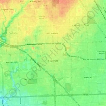
Name: Southfield topographic map, elevation, terrain.
Location: Southfield, Oakland County, Michigan, États-Unis (42.44203 -83.31994 42.51747 -83.20052)
Average elevation: 210 m
Minimum elevation: 189 m
Maximum elevation: 232 m