Geolocate

Pigna topographic map

Click on the map to display elevation.

About this map
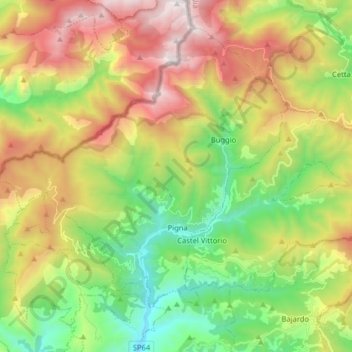
Name: Pigna topographic map, elevation, terrain.

Location: Pigna, Provincia di Imperia, Liguria, 18037, Italy (43.90073 7.58158 43.99841 7.74135)

Average elevation: 908 m

Minimum elevation: 132 m

Maximum elevation: 2,017 m

Other topographic maps

Click on a map to view its topography, its elevation and its terrain.

Andagna

Italy > Provincia di Imperia

Average elevation: 726 m

Gear up for your next adventure:

🔥Camping Stoves - Portable stoves for outdoor cooking
🧺Fast-Dry Microfiber Towels - Large towels that pack down to the size of an orange
🧼Biodegradable Outdoor Soap - Clean gear and yourself without harming the local ecosystem
🥶Thermal Beanies - Warm hats for cold hikes
🐍Snake Gaiters - Protection against snake bites

As an Amazon Associate, this site earns from qualifying purchases at no extra cost to you.