
Schwiesau topographic map
Interactive map
Click on the map to display elevation.
About this map
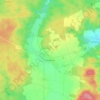
Name: Schwiesau topographic map, elevation, terrain.
Average elevation: 95 m
Minimum elevation: 51 m
Maximum elevation: 152 m
Im Jahr 1588 wurde die Roggenernte des Orts durch Hagel zerstört. Der Schaden war so groß, dass das benachbarte Amt Klötze, für die im Gebiet des Amtes durch Schwiesau angepachtete Weiden, die Haferpacht in Höhe von 60 Scheffeln erließ.