
Saint-Jean-Baptiste topographic map
Interactive map
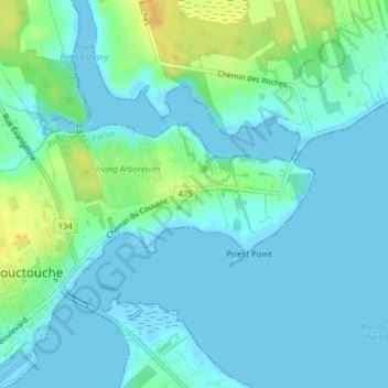
Click on the map to display elevation.
About this map
Name: Saint-Jean-Baptiste topographic map, elevation, terrain.
Average elevation: 7 m
Minimum elevation: -2 m
Maximum elevation: 27 m
Other topographic maps
Click on a map to view its topography, its elevation and its terrain.
Bouctouche
Canada > New Brunswick > Bouctouche
Bouctouche, Wellington Parish, Kent County, New Brunswick, Canada
Average elevation: 16 m
Buctouche Harbour
Canada > New Brunswick > Bouctouche
Buctouche Harbour, Rue G.E.Klomfass, Bouctouche, Wellington Parish, Kent County, New Brunswick, E4S 4A5, Canada
Average elevation: 2 m