
Ifran topographic map
Interactive map
Click on the map to display elevation.
About this map
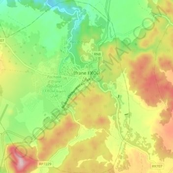
Name: Ifran topographic map, elevation, terrain.
Average elevation: 1,668 m
Minimum elevation: 1,534 m
Maximum elevation: 1,838 m
Ifrane liegt auf einer Höhe von etwa 1650 Metern, 65 km (Fahrtstrecke) südlich von Fès und 18 Kilometer nordöstlich von Azrou. In der Nähe liegen der Nationalpark Ifrane mit den beiden erloschenen Vulkankratern des Jbel Mischliffen und des Jbel Hebri.