
Sedbusk topographic map
Interactive map
Click on the map to display elevation.
About this map
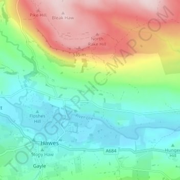
Name: Sedbusk topographic map, elevation, terrain.
Average elevation: 338 m
Minimum elevation: 221 m
Maximum elevation: 564 m
Other topographic maps
Click on a map to view its topography, its elevation and its terrain.
Whitby
Verenigd Koninkrijk > Engeland > North Yorkshire
Whitby, North Yorkshire, Engeland, Verenigd Koninkrijk
Average elevation: 37 m
Redcar
Verenigd Koninkrijk > Engeland > North Yorkshire
Redcar, North Yorkshire, Tees Valley, Engeland, TS10 1DZ, Verenigd Koninkrijk
Average elevation: 8 m
Cotterdale
Verenigd Koninkrijk > Engeland > North Yorkshire
Cotterdale, North Yorkshire, Engeland, DL8 3LT, Verenigd Koninkrijk
Average elevation: 435 m