
Independencia topographic map
Interactive map
Click on the map to display elevation.
About this map
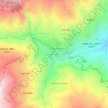
Name: Independencia topographic map, elevation, terrain.
Location: Independencia, Ayopaya, CBA, Bolivia (-17.10415 -66.83945 -17.06415 -66.79945)
Average elevation: 2,854 m
Minimum elevation: 2,436 m
Maximum elevation: 3,286 m