
Boyneburg topographic map
Interactive map
Click on the map to display elevation.
About this map
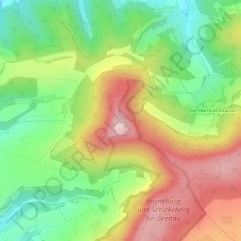
Name: Boyneburg topographic map, elevation, terrain.
Average elevation: 361 m
Minimum elevation: 236 m
Maximum elevation: 512 m
Other topographic maps
Click on a map to view its topography, its elevation and its terrain.
Ulfe
Deutschland > Hessen > Sontra
Ulfe, Sontra, Werra-Meißner-Kreis, Regierungsbezirk Kassel, Hessen, 36214, Deutschland
Average elevation: 343 m