
Oberriet topographic map
Interactive map
Click on the map to display elevation.
About this map
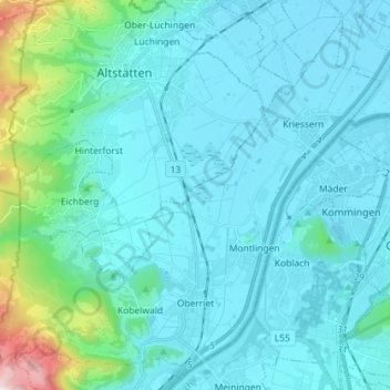
Name: Oberriet topographic map, elevation, terrain.
Location: Oberriet, Wahlkreis Rheintal, St. Gallen, Schweiz (47.30412 9.49251 47.39108 9.63601)
Average elevation: 528 m
Minimum elevation: 404 m
Maximum elevation: 1,487 m
Other topographic maps
Click on a map to view its topography, its elevation and its terrain.
Montlingen
Schweiz > St. Gallen > Wahlkreis Rheintal
Montlingen, Oberriet, Wahlkreis Rheintal, St. Gallen, 9462, Schweiz
Average elevation: 427 m
Au (SG)
Schweiz > St. Gallen > Wahlkreis Rheintal
Au (SG), Wahlkreis Rheintal, St. Gallen, Schweiz
Average elevation: 441 m