
El Arroyal topographic map
Interactive map
Click on the map to display elevation.
About this map
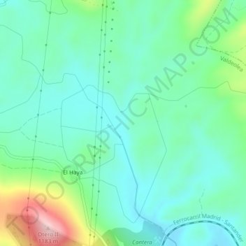
Name: El Arroyal topographic map, elevation, terrain.
Average elevation: 994 m
Minimum elevation: 934 m
Maximum elevation: 1,173 m
Other topographic maps
Click on a map to view its topography, its elevation and its terrain.
Reinosilla
España > Cantabria > Valdeolea
Reinosilla, Valdeolea, Cantabria, 39418, España
Average elevation: 1,019 m