
Sincelejo topographic map
Interactive map
Click on the map to display elevation.
About this map
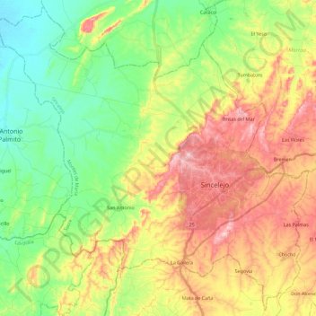
Name: Sincelejo topographic map, elevation, terrain.
Location: Sincelejo, Sucre, Colômbia (9.20842 -75.55096 9.42236 -75.32598)
Average elevation: 115 m
Minimum elevation: 17 m
Maximum elevation: 250 m
Other topographic maps
Click on a map to view its topography, its elevation and its terrain.