
Comuna Cumanday topographic map
Interactive map
Click on the map to display elevation.
About this map
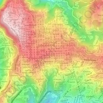
Name: Comuna Cumanday topographic map, elevation, terrain.
Location: Comuna Cumanday, Manizales, Centrosur, Caldas, Colombia (5.06130 -75.52485 5.07356 -75.50714)
Average elevation: 2,059 m
Minimum elevation: 1,856 m
Maximum elevation: 2,196 m