
Guamúchil topographic map
Interactive map
Click on the map to display elevation.
About this map
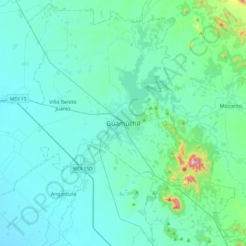
Name: Guamúchil topographic map, elevation, terrain.
Location: Guamúchil, Salvador Alvarado, Sinaloa, 81460, México (25.29755 -108.23554 25.61755 -107.91554)
Average elevation: 74 m
Minimum elevation: 9 m
Maximum elevation: 625 m
Other topographic maps
Click on a map to view its topography, its elevation and its terrain.
Las Peñitas
México > Sinaloa > Guamúchil > Las Peñitas
Las Peñitas, Guamúchil, Salvador Alvarado, Sinaloa, 81427, México
Average elevation: 55 m