Geolocate

Hemsworth topographic map

Click on the map to display elevation.

About this map

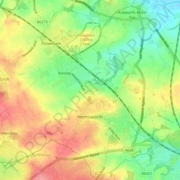
Name: Hemsworth topographic map, elevation, terrain.

Location: Hemsworth, Wakefield, West Yorkshire, England, United Kingdom (53.59535 -1.40117 53.64602 -1.32019)

Average elevation: 64 m

Minimum elevation: 25 m

Maximum elevation: 108 m

Gear up for your next adventure:

🥶Thermal Beanies - Warm hats for cold hikes
🧥Packable Rain Jackets - Breathable waterproof layers for unpredictable mountain weather
🕯️Emergency Whistles - Safety whistles for hiking
📖Australian Bush Survival Books - Local knowledge on finding water and surviving the outback
🧣Merino Neck Gaiters - Versatile headwear for warmth, sun protection, or dust filtering

As an Amazon Associate, this site earns from qualifying purchases at no extra cost to you.