
Thank you for supporting this site ❤️
Make a donation
Make a donation
Gear up for your next adventure:
As an Amazon Associate, this site earns from qualifying purchases at no extra cost to you.
Skebobruk topographic map
Click on the map to display elevation.
Thank you for supporting this site ❤️
Make a donation
Make a donation
Gear up for your next adventure:
As an Amazon Associate, this site earns from qualifying purchases at no extra cost to you.
About this map
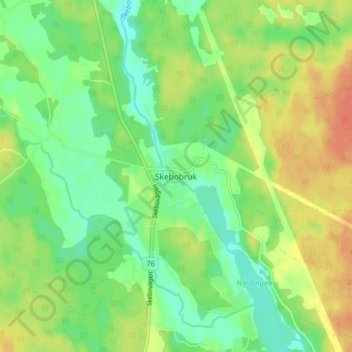
Name: Skebobruk topographic map, elevation, terrain.
Location: Skebobruk, Norrtälje kommun, Stockholm County, Sweden (59.94855 18.59202 59.98855 18.63202)
Average elevation: 19 m
Minimum elevation: 1 m
Maximum elevation: 42 m
Thank you for supporting this site ❤️
Make a donation
Make a donation
Gear up for your next adventure:
As an Amazon Associate, this site earns from qualifying purchases at no extra cost to you.