Geolocate

Milton topographic map

Click on the map to display elevation.

About this map

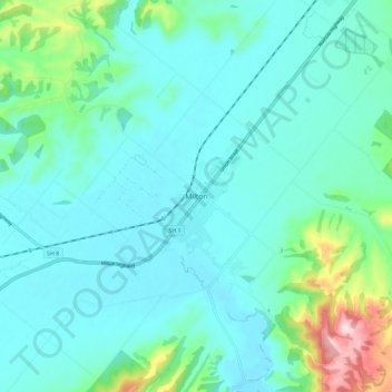
Name: Milton topographic map, elevation, terrain.

Location: Milton, Clutha District, Otago, 9220, New Zealand (-46.15678 169.92245 -46.07678 170.00245)

Average elevation: 55 m

Minimum elevation: 2 m

Maximum elevation: 314 m

Other topographic maps

Click on a map to view its topography, its elevation and its terrain.

Devils Gorge

New Zealand > Otago > Clutha District

Average elevation: 492 m

Gear up for your next adventure:

🪑Portable Backpacking Chairs - A comfortable seat for studying maps at the end of the day
👄SPF Lip Balm - Prevent sun and wind-burnt lips on mountain ridges
📖Australian Bush Survival Books - Local knowledge on finding water and surviving the outback
🪫Rechargeable Headlamps - USB rechargeable headlamps
📕Australia Maps - Maps covering Australian regions

As an Amazon Associate, this site earns from qualifying purchases at no extra cost to you.