
Lac Loranger topographic map
Interactive map
Click on the map to display elevation.
About this map
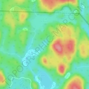
Name: Lac Loranger topographic map, elevation, terrain.
Average elevation: 344 m
Minimum elevation: 308 m
Maximum elevation: 407 m
Other topographic maps
Click on a map to view its topography, its elevation and its terrain.
Lac Jeune
Canada > Québec > Portneuf (MRC) > Lac-Lapeyrere
Lac Jeune, Lac-Lapeyrere, Portneuf (MRC), Capitale-Nationale, Québec, Canada
Average elevation: 383 m