
Jackson topographic map
Interactive map
Click on the map to display elevation.
About this map
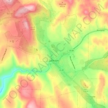
Name: Jackson topographic map, elevation, terrain.
Location: Jackson, Amador County, Californie, États-Unis d'Amérique (38.33029 -120.79857 38.37216 -120.74896)
Average elevation: 421 m
Minimum elevation: 300 m
Maximum elevation: 512 m
Other topographic maps
Click on a map to view its topography, its elevation and its terrain.
Ione
États-Unis d'Amérique > Californie > Amador County
Ione, Amador County, Californie, 95640, États-Unis d'Amérique
Average elevation: 126 m