
Thank you for supporting this site ❤️
Make a donation
Make a donation
Gear up for your next adventure:
As an Amazon Associate, this site earns from qualifying purchases at no extra cost to you.
Skebokvarn topographic map
Click on the map to display elevation.
Thank you for supporting this site ❤️
Make a donation
Make a donation
Gear up for your next adventure:
As an Amazon Associate, this site earns from qualifying purchases at no extra cost to you.
About this map
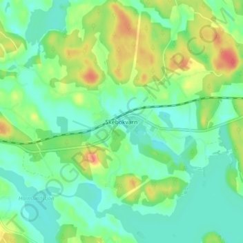
Name: Skebokvarn topographic map, elevation, terrain.
Location: Skebokvarn, Flens kommun, Södermanland County, 642 91, Sweden (59.04355 16.69446 59.08355 16.73446)
Average elevation: 36 m
Minimum elevation: 19 m
Maximum elevation: 69 m
Thank you for supporting this site ❤️
Make a donation
Make a donation
Gear up for your next adventure:
As an Amazon Associate, this site earns from qualifying purchases at no extra cost to you.