
Lüdersen topographic map
Interactive map
Click on the map to display elevation.
About this map
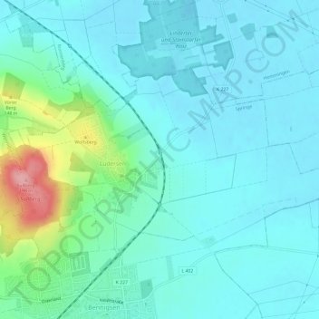
Name: Lüdersen topographic map, elevation, terrain.
Location: Lüdersen, Springe, Region Hannover, Niedersachsen, Deutschland (52.24465 9.65083 52.26541 9.71011)
Average elevation: 92 m
Minimum elevation: 67 m
Maximum elevation: 203 m
Other topographic maps
Click on a map to view its topography, its elevation and its terrain.
Völksen
Deutschland > Niedersachsen > Region Hannover > Springe > Völksen
Völksen, Springe, Region Hannover, Niedersachsen, 31832, Deutschland
Average elevation: 130 m