
Polleur topographic map
Interactive map
Click on the map to display elevation.
About this map
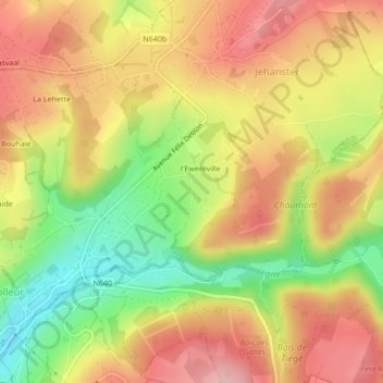
Name: Polleur topographic map, elevation, terrain.
Location: Polleur, Eweréville, Liège, Wallonie, 4910, Belgique (50.54589 5.89903 50.54825 5.89928)
Average elevation: 302 m
Minimum elevation: 213 m
Maximum elevation: 371 m