Geolocate

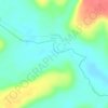
Pitinga topographic map

Click on the map to display elevation.

About this map

Name: Pitinga topographic map, elevation, terrain.

Location: Pitinga, Balbina, Presidente Figueiredo, Região Geográfica Imediata de Manaus, Região Geográfica Intermediária de Manaus, Amazonas, Região Norte, Brasil (-0.79751 -60.09208 -0.75751 -60.05208)

Average elevation: 204 m

Minimum elevation: 137 m

Maximum elevation: 277 m

Other topographic maps

Click on a map to view its topography, its elevation and its terrain.
Balbina

Brasil > Amazonas > Presidente Figueiredo

Average elevation: 107 m

Rio Urubu

Brasil > Amazonas > Presidente Figueiredo

Average elevation: 115 m

Rio Urubuí

Brasil > Amazonas > Presidente Figueiredo

Average elevation: 130 m

Gear up for your next adventure:

📣High-Decibel Survival Whistles - Signaling tool for rescue that carries much further than a human voice
⌚GPS Watches - GPS watches for outdoor sports
👕UPF 50+ Sun Shirts - Essential protection against the harsh Australian sun during field work
🕯️Emergency Whistles - Safety whistles for hiking
📡Satellite Messengers - Emergency communication devices

As an Amazon Associate, this site earns from qualifying purchases at no extra cost to you.