
Dobra Voda topographic map
Interactive map
Click on the map to display elevation.
About this map
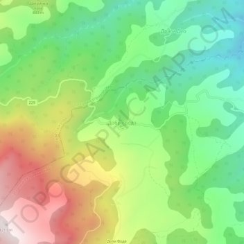
Name: Dobra Voda topographic map, elevation, terrain.
Average elevation: 772 m
Minimum elevation: 432 m
Maximum elevation: 1,281 m
Other topographic maps
Click on a map to view its topography, its elevation and its terrain.
Radan
Serbia > Central Serbia > Jablanica Administrative District > Bojnik Municipality
Radan, Bojnik Municipality, Jablanica Administrative District, Central Serbia, Serbia
Average elevation: 1,272 m