Geolocate

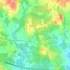
Pluckemin topographic map

Click on the map to display elevation.

About this map

Name: Pluckemin topographic map, elevation, terrain.

Location: Pluckemin, Bedminster Township, Somerset County, New Jersey, 07978, United States (40.62566 -74.65905 40.66566 -74.61905)

Average elevation: 77 m

Minimum elevation: 27 m

Maximum elevation: 186 m

Other topographic maps

Click on a map to view its topography, its elevation and its terrain.
Gear up for your next adventure:

🧢Outdoor Sun Hats - Sun protection hats for hiking
📖Australian Bush Survival Books - Local knowledge on finding water and surviving the outback
⌚Altimeter Watches - Watches with altitude tracking
📟Satellite Messengers - Two-way satellite communication to stay in touch beyond the cellular grid
🌧️Rain Jackets - Waterproof jackets for hiking

As an Amazon Associate, this site earns from qualifying purchases at no extra cost to you.