
Ganges topographic map
Click on the map to display elevation.
About this map
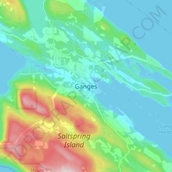
Name: Ganges topographic map, elevation, terrain.
Average elevation: 113 m
Minimum elevation: -2 m
Maximum elevation: 480 m
Other topographic maps
Click on a map to view its topography, its elevation and its terrain.
Saltspring Island
Canada > British Columbia > Capital Regional District > Salt Spring Island Electoral Area
Average elevation: 72 m
Saltspring Island
Canada > British Columbia > Capital Regional District > Salt Spring Island Electoral Area
Average elevation: 72 m
Saltspring Island
Canada > British Columbia > Capital Regional District > Salt Spring Island Electoral Area
Average elevation: 72 m