
Osmaniye topographic map
Interactive map
Click on the map to display elevation.
Osmaniye
Osmaniye (pronounced ) is a city in the Çukurova region of Turkey, the capital of Osmaniye Province. Area 3,767 km². Population of Osmaniye city: 219,339. Osmaniye Province: 512,804 (2014). Osmaniye is at an elevation of 125 meters (410.1 feet).
About this map
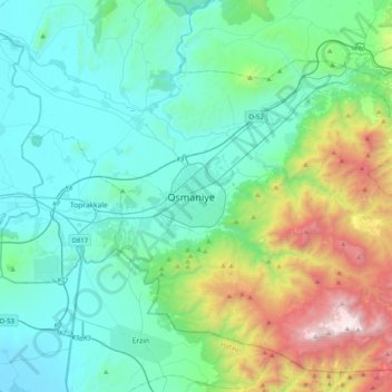
Name: Osmaniye topographic map, elevation, terrain.
Average elevation: 453 m
Minimum elevation: 0 m
Maximum elevation: 2,166 m