
محافظة الضالع topographic map
Interactive map
Click on the map to display elevation.
About this map
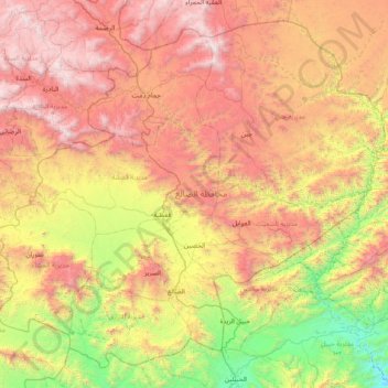
Name: محافظة الضالع topographic map, elevation, terrain.
Location: محافظة الضالع, Jemen (13.55013 44.36877 14.23462 45.15636)
Average elevation: 1,681 m
Minimum elevation: 431 m
Maximum elevation: 3,141 m