Geolocate

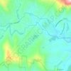
Brevard topographic map

Click on the map to display elevation.

About this map
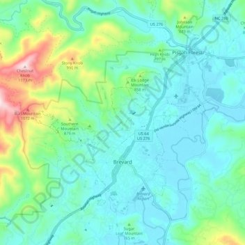
Name: Brevard topographic map, elevation, terrain.

Location: Brevard, Transylvania County, North Carolina, United States (35.20933 -82.79070 35.28541 -82.68419)

Average elevation: 745 m

Minimum elevation: 633 m

Maximum elevation: 1,167 m

Other topographic maps

Click on a map to view its topography, its elevation and its terrain.
Gear up for your next adventure:

📱Tablet Tripod Mounts - Steady platforms for viewing digital maps or taking long exposures
📕Hiking Guide Books - Guides for hiking trails
🔪Outdoor Multi-tools - Versatile tools for gear repair and survival tasks in the wilderness
🖼️Scratch-off Australia Map - Track the regions and peaks you have explored geographically
🎧Bluetooth Outdoor Earbuds - Listen to navigation cues or podcasts during long solo treks

As an Amazon Associate, this site earns from qualifying purchases at no extra cost to you.