
Monte Caldera topographic map
Interactive map
Click on the map to display elevation.
About this map
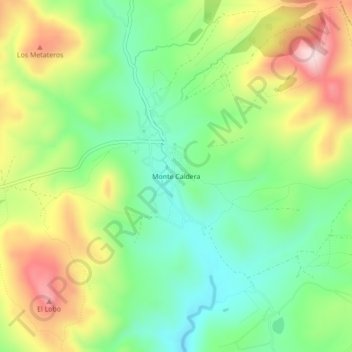
Name: Monte Caldera topographic map, elevation, terrain.
Location: Monte Caldera, Cerro de San Pedro, San Luis Potosí, México (22.18900 -100.76410 22.22900 -100.72410)
Average elevation: 2,172 m
Minimum elevation: 2,044 m
Maximum elevation: 2,364 m
Other topographic maps
Click on a map to view its topography, its elevation and its terrain.
Cerro de San Pedro
México > San Luis Potosí > Cerro de San Pedro
Cerro de San Pedro, San Luis Potosí, México
Average elevation: 2,025 m