
Gregaine topographic map
Interactive map
Click on the map to display elevation.
About this map
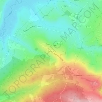
Name: Gregaine topographic map, elevation, terrain.
Average elevation: 331 m
Minimum elevation: 250 m
Maximum elevation: 469 m
Other topographic maps
Click on a map to view its topography, its elevation and its terrain.
Polien
France > Bourgogne-Franche-Comté > Saône-et-Loire > Sarry
Polien, Sarry, Charolles, Saône-et-Loire, Bourgogne-Franche-Comté, France métropolitaine, 71110, France
Average elevation: 305 m
Sarry
France > Bourgogne-Franche-Comté > Saône-et-Loire > Sarry
Sarry, Charolles, Saône-et-Loire, Bourgogne-Franche-Comté, France métropolitaine, 71110, France
Average elevation: 315 m