
Cat Hai topographic map
Interactive map
Click on the map to display elevation.
About this map
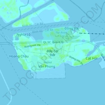
Name: Cat Hai topographic map, elevation, terrain.
Location: Cat Hai, Cát Hải District, Haiphong, Vietnam (20.78608 106.84483 20.81684 106.90992)
Average elevation: 1 m
Minimum elevation: -2 m
Maximum elevation: 8 m
Other topographic maps
Click on a map to view its topography, its elevation and its terrain.