
Greenwood Village topographic map
Interactive map
Click on the map to display elevation.
About this map
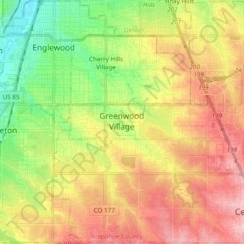
Name: Greenwood Village topographic map, elevation, terrain.
Location: Greenwood Village, Arapahoe County, Colorado, VS (39.58754 -104.98064 39.64594 -104.84772)
Average elevation: 1,685 m
Minimum elevation: 1,601 m
Maximum elevation: 1,774 m