Geolocate

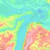
Atodi topographic map

Click on the map to display elevation.

About this map

Name: Atodi topographic map, elevation, terrain.

Location: Atodi, Santarém, Região Geográfica Imediata de Santarém, Região Geográfica Intermediária de Santarém, Pará, Região Norte, Brasil (-2.53223 -55.25617 -2.49223 -55.21617)

Average elevation: 13 m

Minimum elevation: -2 m

Maximum elevation: 48 m

Other topographic maps

Click on a map to view its topography, its elevation and its terrain.

Curuai

Brasil > Pará > Santarém

Average elevation: 25 m

Alter do Chão

Brasil > Pará > Santarém

Average elevation: 46 m

Terrenos

Brasil > Pará > Santarém

Average elevation: 45 m

Gear up for your next adventure:

🪢Paracord - Multi-purpose survival cord
🩹Blister Prevention Tape - Apply to friction points before they become painful sores
🕶️Polarized Outdoor Sunglasses - Reduce glare from rocks and water for better visual navigation
🛌Compact Down Sleeping Bags - Warmth without the bulk, ideal for backcountry camping
🧼Clip-on Hand Sanitizer - Maintain hygiene when water for washing is scarce

As an Amazon Associate, this site earns from qualifying purchases at no extra cost to you.