
Irún topographic map
Interactive map
Click on the map to display elevation.
About this map
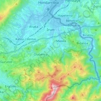
Name: Irún topographic map, elevation, terrain.
Location: Irún, Bajo Bidasoa, Guipúzcoa, País Vasco, España (43.28642 -1.85226 43.35327 -1.72927)
Average elevation: 163 m
Minimum elevation: -4 m
Maximum elevation: 794 m