
Make a donation
Gear up for your next adventure:
As an Amazon Associate, this site earns from qualifying purchases at no extra cost to you.
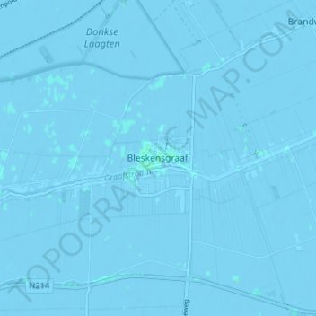
Bleskensgraaf topographic map
Click on the map to display elevation.
Make a donation
Gear up for your next adventure:
As an Amazon Associate, this site earns from qualifying purchases at no extra cost to you.
Bleskensgraaf
Het dorp is gelegen aan het riviertje de Graafstroom. Zoals de naam al aangeeft is dit eigenlijk een gegraven kanaal, dat aansluit op het riviertje de Alblas. In het dorp is te zien hoe het rechte gegraven deel (de Graafstroom) ter hoogte van de Wijngaardseweg overgaat in de kronkelende rivier (De Alblas), die door Bleskensgraaf, Oud Alblas en Alblasserdam stroomt en daar in de Noord uitmondt.
Make a donation
Gear up for your next adventure:
As an Amazon Associate, this site earns from qualifying purchases at no extra cost to you.
About this map
Name: Bleskensgraaf topographic map, elevation, terrain.
Average elevation: -1 m
Minimum elevation: -4 m
Maximum elevation: 3 m
Make a donation
Gear up for your next adventure:
As an Amazon Associate, this site earns from qualifying purchases at no extra cost to you.