
Goughs Bay topographic map
Interactive map
Click on the map to display elevation.
About this map
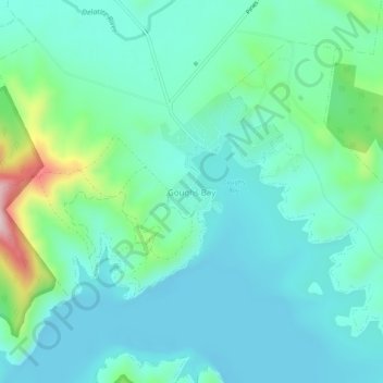
Name: Goughs Bay topographic map, elevation, terrain.
Location: Goughs Bay, Mt Buller Mt Stirling, Victoria, Australia (-37.20613 146.04671 -37.16613 146.08671)
Average elevation: 323 m
Minimum elevation: 251 m
Maximum elevation: 614 m