
東北地方 topographic map
Interactive map
Click on the map to display elevation.
About this map
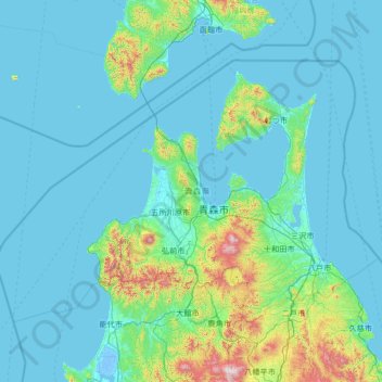
Name: 東北地方 topographic map, elevation, terrain.
Location: Prefectura de Aomori, 東北地方, Japón (40.21772 139.23411 41.60606 141.90397)
Average elevation: 120 m
Minimum elevation: -5 m
Maximum elevation: 1,591 m
Other topographic maps
Click on a map to view its topography, its elevation and its terrain.