
墾丁國家公園 topographic map
Interactive map
Click on the map to display elevation.
About this map
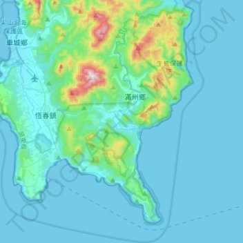
Name: 墾丁國家公園 topographic map, elevation, terrain.
Location: 墾丁國家公園, 港口路220巷, 港口村, 滿州鄉, 屏東縣, 臺灣省, 947, Taiwan (21.87769 120.67686 22.11483 120.91128)
Average elevation: 70 m
Minimum elevation: -1 m
Maximum elevation: 659 m