Geolocate

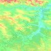
Stanyn topographic map

Click on the map to display elevation.

About this map

Name: Stanyn topographic map, elevation, terrain.

Location: Stanyn, Radekhiv Urban Hromada, Sheptytskyi Raion, Lviv Oblast, 80250, Ukraine (50.25806 24.54739 50.29806 24.58739)

Average elevation: 232 m

Minimum elevation: 218 m

Maximum elevation: 250 m

Other topographic maps

Click on a map to view its topography, its elevation and its terrain.

Gear up for your next adventure:

📸Action Cameras - Record your journey across interesting topographic features in 4K
📣High-Decibel Survival Whistles - Signaling tool for rescue that carries much further than a human voice
📕Hiking Guide Books - Guides for hiking trails
📡Weather Radios - Emergency weather radios
🎒Dry Bags - Waterproof bags for outdoor gear

As an Amazon Associate, this site earns from qualifying purchases at no extra cost to you.